Let the satellites do the work for you!!
Gain soil insights without the need for physical sensors.
What We Do?
We extract parameters from your soil, calibrate them into an advanced soil report
Soil Report
Fertility Mapping
Realtime Dashboard
Soil Report
The Advance Soil Report is a smart, easy-to-understand PDF that gives a complete
picture of your farm’s soil health. Using the latest satellite data and AI technology, it provides a
simple one-page summary, followed by a clear table showing key soil values like moisture, nutrients, and
pH, along with ideal ranges and easy explanations. It also includes helpful charts, AI-based farming
suggestions, and an overall soil health score to guide your next steps. The report is available in both
English and Hindi, making it accessible to more farmers across the country.
Fertility Mapping
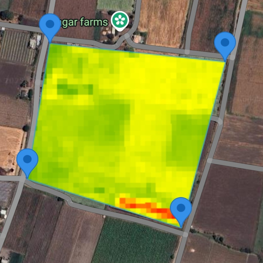
Fertility Mapping helps you see which parts of your field are doing well and
which need more help. It’s an easy tool for farmers, gardeners, or anyone with land. You just draw your
farm on a simple map in our app. The app then looks at recent pictures taken by satellites in space,
called Sentinel-2. These pictures show how healthy your soil is. You’ll get a colored map of your land.
so you don’t need to add much. This colored map makes it clear where to focus. It saves you time because
you don’t have to guess where to put fertilizer. No sensors are needed on your farm—satellites do all
the work from above. It’s a simple way to make your farming better and get more from your land.
Real-time Dashboard
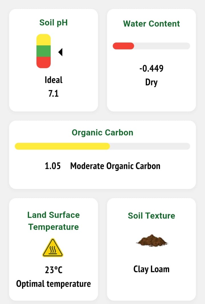
The FarmMatrix Soil Monitoring Dashboard gives farmers a clear and simple way to
check their field’s condition all in one place. It shows important details like soil moisture,
temperature, soil type, and how healthy the soil is. Everything is easy to understand with simple words,
icons, and colors—like green for good, yellow for okay, and red for needs work. No hard words or
complicated steps—just helpful information to make farming decisions every day. The dashboard uses
satellite pictures from space, so you don’t need any sensors on your farm. It’s a simple tool to help
you take care of your land and get better harvests.
7+ Parameters
4+ Satellites
>70% Accuracy
What Customer's Say
Frequently Asked Questions
What does FarmMatrix do?+
FarmMatrix uses satellite technology to analyze your soil’s health and fertility. Our Features—the
Advance Soil Report, Soil Monitoring Dashboard, and Fertility Mapping—give you clear insights to grow
better crops, save on fertilizers, and keep your soil healthy, all without ground sensors.
How to map our field?+
You can map your field using GPS coordinates or by drawing the boundary directly on the satellite map
provided in the app.
How do I use this?+
It’s easy! For the Advance Soil Report ,Soil Monitoring Dashboard and Fertility Mapping,Just Map Your
Soil ,Everything is user-friendly and available in English and Hindi.
Do I need to install sensors on my farm?+
No, you don’t! FarmMatrix relies entirely on satellite data from Sentinel-2 and MODIS. We analyze your
soil from space, so there’s no need for on-site sensors or equipment—just your field’s location and our
app.
How does satellite technology actually work to analyze my soil?+
Satellites like Sentinel-2 take detailed pictures of your field from space, capturing things like plant
health, soil moisture, and temperature. These images use special light wavelengths (like infrared) to
detect differences in your soil and crops. Our AI then processes this data to measure fertility,
moisture, and more, turning it into simple maps and reports for you to use—all without stepping foot on
your farm.
Is the data accurate if it’s only from satellites?+
Yes, it’s very accurate! Satellites provide a big-picture view of your field, capturing data
consistently across large areas. We use advanced AI to analyze this data, giving you reliable insights
about your soil’s health, fertility, and water needs. While it’s not the same as a lab test, it’s a
powerful way to monitor your fields and make informed decisions.
How often is the data updated?+
We use the most recent satellite data available, typically from the past few weeks, to ensure you
get up-to-date insights. For example, the Fertility Mapping tool might use data from the last 30 days,
depending on cloud cover and satellite passes.